Lessons From Atlanta: Tackling Cairo's Urban Sprawl
A case study in urban sprawl, Atlanta is now finding innovative and inclusive solutions to the outward development. Progrss compares it to Cairo's similar experience and the consequent lack of connectivity, community spirit, and equal access to opportunity, which still plague the city today.
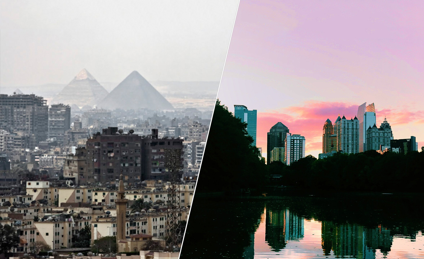
As one of the world’s oldest cities, it’s perhaps no surprise that Cairo, Egypt, has grown into one of the world’s biggest cities, too. Built originally around the Nile, the beating heart of many African countries along its basin, Cairo has crept into the desert, first slowly, and now at a rapid rate as satellite cities, both east and west of the urban core, become the aspirational residential destinations for a growing population. Agricultural land, too, has been steadily developed into tightly-packed residential stock, often informally, other times only semi-legally. Meanwhile, in the nooks and crannies of the dense city core, illegal slums form, fall, and form again in a cat-and-mouse chase between authorities and Cairo’s poorest; on several occasions, the Egyptian government has torn down illegal settlements and resettled their residents in the same satellite cities being rapidly filled with gated communities and luxury homes. Characterised by the pitfalls of top-down city planning – namely, a lack of understanding of local individual and community behaviors and needs and a disregard for the benefits of inclusionary development – Cairo finds itself transferring the same bad habits that inspired its manifesto for growth to the neighbourhoods and districts that are touted as solutions.
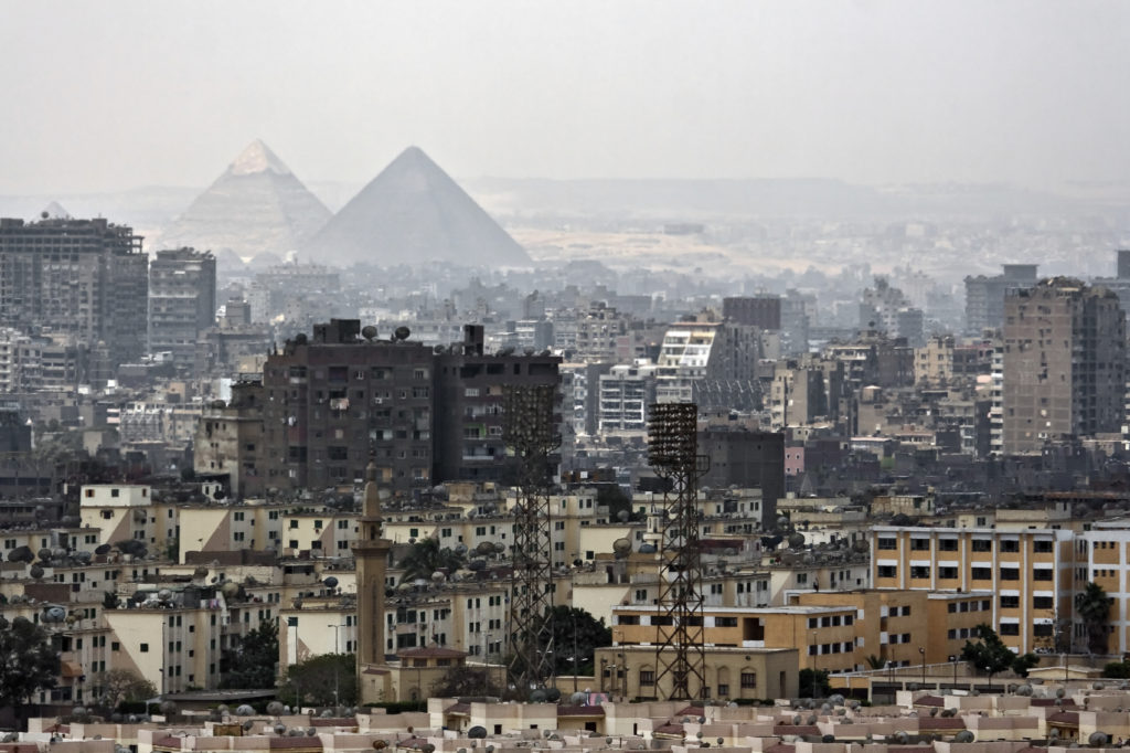
Cairo’s urban sprawl encroaches into the desert in the west, circulating the Great Pyramids in Giza.
Another case study in the perils of rapid urban sprawl is Atlanta, Georgia, where a spike in population growth triggered massive infrastructural development: in 1970, the population was just 1.8 million, today it exceeds 5.5 million. Between 1980 and 1990, urban land in Atlanta expanded 25% and between 1990 and 1996, an explosive 47% more urban land was added. During another boom between 2000 and 2010, some 35% expansion in urban land was recorded. Meanwhile, an analysis of urban growth in Cairo using remote sensing and GIS discovered that the urban area of Cairo was 233.78 km2 in 1973 and increased to 557.87 km2 in 2006. The cut-off from agricultural lands was 136.75 km2, whereas urbanization into the neighboring desert was estimated at 187.32 km2 for the same period. Both cities share the geographical characteristic of being low-lying and largely flat, and thus it becomes easy for the radius of a city to continue to develop outwards with few obstacles. As governments in both cities sought to ease their population swell by selling off land to developers to ensure enough housing stock, suburban dwelling soared.
In Cairo, young families and first-time buyers were driven out by soaring rent and ownership prices, while much prime real estate remains within families, inherited by a generation before being passed on to the next. Meanwhile, wealthy Cairenes were, and continue to be, tempted out to the two large satellite cities, 6th October City and New Cairo, for their luxury developments where sprawling villas and private pools are built quickly in lush, gated compounds. It is the latter experience that went on to define these satellite cities,despite their original intention being to provide low cost housing for the working class. 6th October City was officially created as a factory-based city in 1979 and now stands at 12 times the area originally prescribed in its plan, prompting the government to present a new plan by 2007. This same period would see “a much more “capitalist” mode of development applied,” in the East too, as “the boundaries of existing new towns and settlements were rearranged and dramatically extended, particularly in those cities around Cairo which were considered to have development potential. Those cities were merged and boundaries were extended to create New Cairo.”
Meanwhile, in 1998, growth in Atlanta’s suburbs was 100 times the growth in the city. Today, that means the inner-city is sparsely populated with the west and south sides particularly vacant. “Our challenge is to make the city a real city in the sense of a cohesive public realm, and that typically happens in downtowns. The city of Atlanta with a population of 1.5 million will be a better place to live than a city which currently stands at just half a million,” says Atlanta’s Commissioner of Planning and Community Development, Tim Keane on a city’s intrinsic need for vibrancy. While Cairo still urges people to leave the inner city, Atlanta is on a mission to bring residents back to the core.
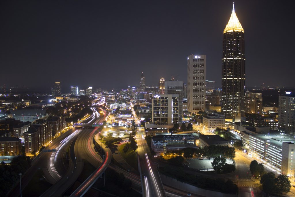
Atlanta’s traffic at night.
As well as an enabling geography and a growing economy, Atlanta’s urban sprawl can be attributed to long-standing segregation and racial tensions – as African American populations in Atlanta grew, wealthy white residents moved out of the city proper and into the spacious, leafy suburbs. With a migration of wealth, the inner city areas became neglected and class and race segregation only grew when the proposed the Metropolitan Atlanta Rapid Transit Authority (MARTA) was opposed by newly-populated, wealthy suburbs, Cobb and Gwinnett. “The white people in the suburbs saw MARTA as a way for black people to come to their counties, and they didn’t want it,” Atlanta Magazine’s Doug Monroe said to the Harvard Political Review. As such, the MARTA became one of the few transportation systems in the USA to not receive state funding, halting its potential expansion.
This underinvestment in public transport has affected the poorest communities the most, as they are physically unable to reach economic or lifestyle-enriching opportunities without a car. Concurrently, even motorists face mobility issues as Atlanta’s streets suffer from slow moving traffic, despite its wide-reaching, high-capacity road infrastructure. In 2014, the city made headlines and citizens flooded social media with complaints as winter storms effectively shut down Atlanta’s freeways and main streets. Motorists were stuck for hours, some even overnight, as the city’s snow plows and road-treatment vehicles were also trapped from the gridlock that ensued when snow fell earlier than weather forecasts expected. “When the weather warning was announced, everyone left their schools and workplaces at the same time and rushed to the freeways,” explains Commissioner of Public Works, Richard Mendoza. “As soon as that was over, we were part of a series of meetings with the City, the State and all our Counties. The lesson we learned – and it has been applied successfully a few times – is to make sure that we have a staggered release. School students leave first, then private businesses, then City employees.”
However, the car-centric mindset is beginning to slowly shift in Atlanta, with more young professionals open to alternative modes of transport and the Atlanta BeltLine having transformed derelict train tracks into a connective, mixed-use trail between 45 neighborhoods. “We’re working to give Atlanta mobility options,” says Commissioner Richard Mendoza. “Our masterplan, Connect Atlanta, has established a goal for bicycle facility inventory and thanks to the Mayor’s efforts over the last year, a $2.5 million bond was voted for with an overwhelming majority so we’re able to add to that.” Meanwhile, Atlanta recently won a federal grant to build a light-rail network and re-introduce the classic streetcar. “It’s the first time we’ve had a streetcar in the city for well over 40 years, and that’s really exciting. While only the first phase covering three miles has been built so far, it’s already had an impact by providing an solution for the last-mile issue,” adds Commissioner Mendoza.
Nevertheless, there’s plenty to be done in terms of increasing mobility and access to and ownership of public space. “People’s expectations about the public realm are changing in Atlanta, and the BeltLine has created that shift,” explains Commissioner Keane. “We’re working on extending these expectations to the whole city.” In fact, Ryan Gravel – the mastermind whose thesis served as the first incarnation of what the BeltLine is today – is working currently from Atlanta’s Office of Planning and Community Development as the department ramps up efforts for inclusive planning and efficient urban design. “We need to decide how big we want the city to grow and how we can implement it best through design. Ryan is the project manager for that,” confirms Commissioner Keane, reiterating the collaborative approach that characterizes the city’s recent development efforts. The department has also announced a direct civic engagement project that hopes to co-opt citizens in the decision-making process that shapes their city. “We’re about to launch the City Studio – a pop up location where we can take the work this department does directly to the communities it affects. In this booth, which moves from location to location, citizens can explore plans and proposals that relate to urban design and growth and give us direct feedback,” says Commissioner Keane.
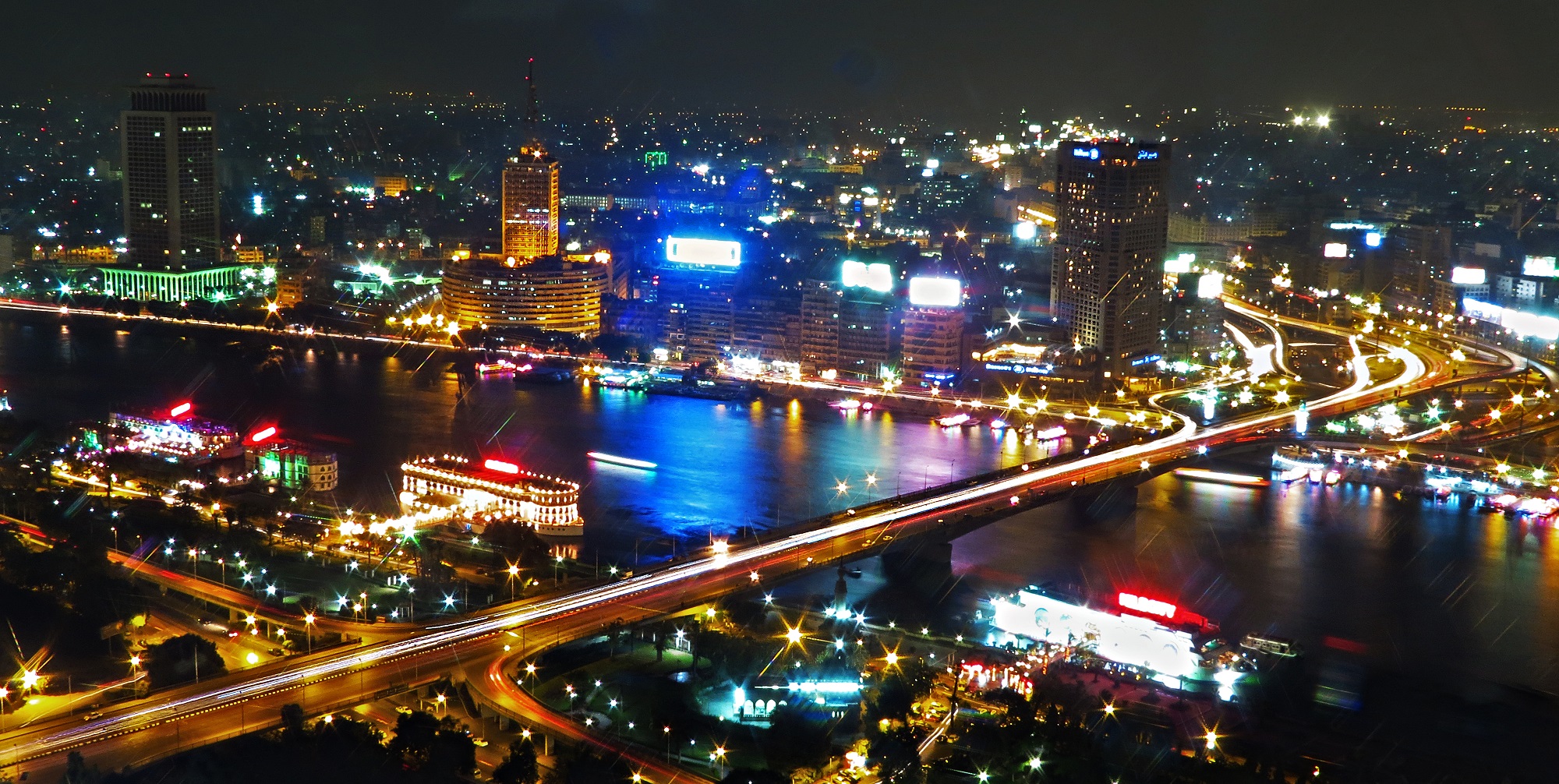
Cairo's traffic at night.
Cairo too suffers from mobility issues exacerbated when viewed from a class perspective, despite an extensive road, bridge and highway infrastructure, and a deep reaching public and privately-operated public transport network. The use of the Cairo Metro is among the highest rate when compared to other global cities, despite it covering a relatively small number of miles. The low-cost and fairly quick form of transport is heavily relied upon by those commuting north and south of Downtown Cairo but lines travelling east and west are short, with 6th October City and New Cairo slated to be added to the map by 2020 – however the contract for phase one of this expansion is yet to be awarded. With the Ring Road encompassing most suburbs, with extensions and flyovers built especially to reach New Cairo and 6th October City, easy movement remains theoretical. Cairo’s infrastructure is notoriously poorly-built and potholes, bottlenecks and traffic-halting speed bumps are common causes of its infamous traffic accidents.
Meanwhile, a poor track record of enforcing traffic rules has left Egypt’s streets chaotic, as stop signs are ignored, cars are double parked and accidents are all too common. In fact, a recent study found Cairo traffic to cost Egypt up to 4% of its GDP, yet Cairo has one of the lowest cars per capita ratios in the world – just five cars to every 100 citizens. Naturally, this has made life in satellite cities nearly impossible for the majority of Cairenes who don’t own a car – 6th October City is 32 kilometers from Downtown Cairo; New Cairo is a similar distance in the other direction. However, even commutes between the districts that hug the Nile in the city center can be strenuous – while Cairo has a functioning bus service, and a huge network of privately-operated but publicly-governed microbuses, road transport is chronically slow due to the aforementioned traffic issues and the fact that the inner-city remains very much populated. While Atlanta’s core experienced an exodus to the suburbs, Cairo’s population continued to grow both in the center and on the periphery. As such, Cairo’s skyline is constantly changing, as new high-rise towers pop up both in wealthy areas and poor ones, the latter’s infrastructure and services often incapable of handling these surges in density.
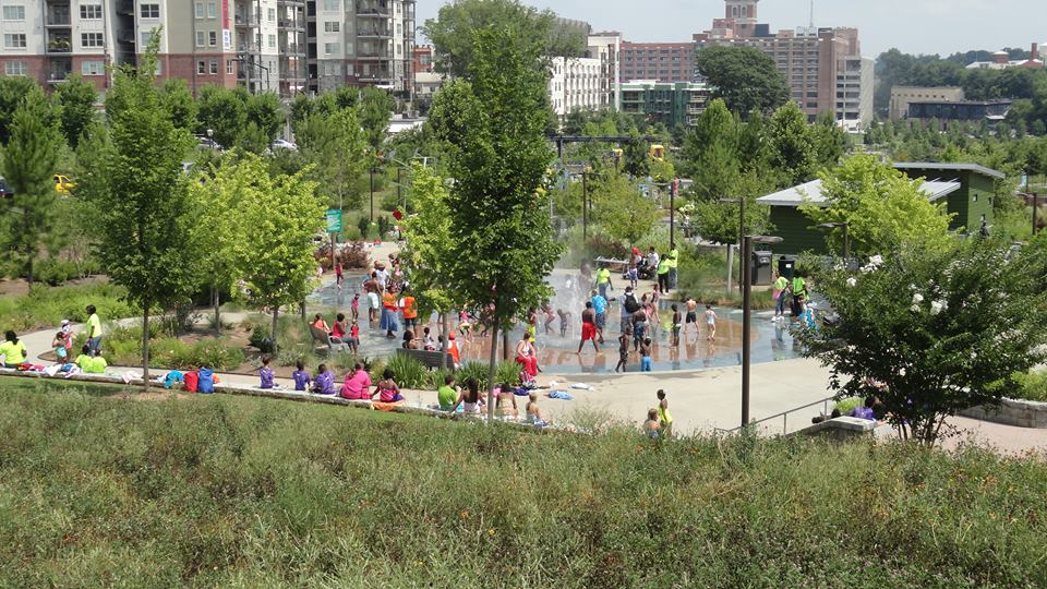
The Atlanta BeltLine.
Once the poster child for urban sprawl, Atlanta now stands apart for its efforts to reverse the damaging effects by revitalizing its urban core, connecting disparate communities and putting inclusion at the top of its economic, social and cultural priorities. The Atlanta BeltLine’s development continues to connect neighborhoods and provide shared, public-space for historically segregated communities. “Everything from a $6 billion capital development program at the airport to the redevelopment of Ponce City Market, the Phillips Arena which will end up anchoring a 3,000-5,000 unit housing development and the Mercedes Benz stadium which we put in a challenged, deprived neighbourhood,” boasts Mayor Kassim Reed about the long list of developmental projects set to inject capital, create jobs and create a sense of community. Meanwhile, Egypt’s governance seems to continue to enforce a top-down urban planning ethos, with a recent announcement to create a brand new administrative capital in the very same ways they created the 6th October City – transferring the current capital’s problems, rather than solving them.

A bazaar is held at a mixed-use leisure development in 6th October City.
Nevertheless, the private sector in Cairo seems to be taking the lead in revitalizing Downtown, with arts, media and tech taking the lead in fostering innovation and providing enriching experiences in the city’s historical center. Co-working spaces and startup incubators take pride in specifically choosing central locations and breathing a breath of fresh air into them, and independent cultural organizations are flourishing in their use of abandoned and forgotten space. Meanwhile, rapid real estate development in New Cairo and 6th October City is finally being followed with leisure, retail, education and business: most Cairo-based universities and private schools have set up new campuses or relocated fully to these very same satellite cities, and large scale manufacturing and corporate headquarters provide the foot traffic necessary to support recreational and retail businesses. Mixed use developments are emerging and marketing themselves as destinations for the urban suburbanite: popular restaurant, bar, fashion and fitness franchises all rub shoulders in the likes of 6th October City’s Arkan Plaza or New Cairo’s Downtown Kattameya Mall, making the live-work-play dream a reality for those who can afford to live around them. While Cairo has a long way to go in consolidating its teeming metropolitan growth and fostering a true sense of belonging and ownership of the city, private and non-governmental efforts are, at least, adding new opportunities to increase liveability even if exclusivity remains.
This article was originally published on progrss.com.
You can check out progrss' #CreativeCitiesUSA project here. For more, check out their Facebook page.
- Previous Article #GetScene: 7 Awesome Instagram Photos This Week
- Next Article 10 Strictly Egyptian Moustaches That Will Inspire You This Movember


